
Duration : 13 Nights / 14 Days
Places Covered : Jammu - Batote - Kishtwar - Galhar - Shasho - Gulabgarh - Chautu - Lo-sa-ling - Sum-Tsan-drog-sa - Kha-Che-Pang-sa - Glacier camp - Gaura - Ating - Padum Grade : C++
» Season : Middle of July to Middle of September
» Highest point Reached : 5240 mts.
» Trek duration : 12 days Day 01 : Jammu/ Batote 200-2200 mts Drive 135 kms.Arrive Jammu. 5 hours drive on Srinagar/ Jammu National Highway to Batote, a small township and also the breakoff point for journey to Srinagar or Kishtwar. Overnight in Tourist Bunglow/ Tents.
Day 02 : Batote/ Kishtwar 2200-1600 mts. Drive 195 kms.
6-7 hours drive to Kishtwar partly on metalled road and partly on fair-weather road all along river Chenab. A short stop at Doda (District Hq's) for lunch. Overnight in forest Bunglow/ tents at Kishtwar.
Day 03 : Kishtwar/ Galhar 1600-1720 mts. Drive 26 kms.
3 hours drive to Galhar Roadhead. Camp high above the gorge of the Chenab river. Overnight in a Forest hut above Galhar.
Day 04 : Galhar/ Shasho 1720-1880 mts. Trek 23 kms.
10 hours long walking up and down various slopes through dense coniferous forests all the time along the bank of river Chenab. Overnight in a Forest Bunglow.
Day 05 : Shasho/ Gulabgarh 1880-2010 mts. Trek 18 kms.
8 hour trek. Meet caravans of Gadi and Gujjar nomads enroute. Pass through the village of Atholi with its ornately carved temples still practising animistic rites. Cross river Chenab and camp at Gulabgarh. Visit the ruins of fort built by the Dogra rulars in 1830. Overnight in tents.
Day 06 : Gulabgarh/ Chautu 2010-3000 mts Trek 12 kms.
7 hours trek. Cross the bridge over Bhut-nallah, enroute visiting some interesting villages. A steep walk up and camp on the sandy shores of the Bhut-Nallah amidst pine forests.Day 07 : Chautu/ Lo-sa-ling 3000-3400 mts. Trek 11 kms.
6-7 hours trek along the stream to an open high altitude valley, Magnificent meadow with sandy beaches on the river which spreads out into a small lake. Continue trek and cross a few rivers, past the village of Machail, encounter the first Tibetan habitation and camp near the village.
Day 08 : Lo-sa-ling/ Sum-Tsan-drog-sa trek 8 kms 3400-3900 mts.
Leave the Bhut-Nallah river and trek into a narrow, V-shaped valley which gives access to the higher plateau of the Himalyan foothills. Pass through another Tibetan village, you come across several waterfalls. Cross one plank bridges to a large open valley called 'The valley of pregnant horses'. Camp near the river.Day 09 : Sum-Tsan-drog-sa
Rest day (To sort out/ check equipment for next few days trek)
Day 10 : Sum-Tsan-drog-sa/ Kha-Che-Pang-sa Trek 9 kms 3900-4300 mts4-5 hours trek, first follow the valley for 4 kms then turn north up the Zanskar Nallah. Steep climb about 400 mts. to a small meadow campsite.
Day 11 : Kha-Che-Pang-sa/ Glacier Camp Trek 19 kms. 4300-4900 mts
Steep climb up the meadow, then along a largelateral Morraine then you come to the Umasi Glacier. Walk across hard ice for 2 kms, continue ascent on very loose scree to large cave-like rocks just short of upper Glacier usually covered with fresh snow even in summer. Campsite on an uneven, rather rough ground.
Day 12 : Glacier camp/ Gaura 4900-5200-4600 mts Trek 14 kms.
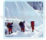
A gradual ascent on snowcovered Glacier to Umasi-la pass. Spectacular views of Zanskar mountains and valleys. The party may rope up for the glacier crossing but Crampons are not necessary. A very steep descent to the other side of pass, another 2 kms. Walk on the Zanskar glacier.
We at Mystical India Tour, have more than 25 years of working experience with reputed companies including Jet Airways, SITA, Mountain Travel Tiger Tops.
More details:View company website
Its Free
Verify Now