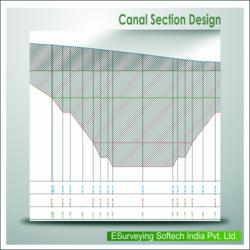

"ESurvey Sections" is a complete Section Creation and Management Solution designed to help engineers, surveyors and designers to create industry standard drawings and to generate instant calculation reports related to Road / Railway lines / Irrigation / Pipeline design / Sewer Network Project.
Key Features & Benefits of ESurvey Section:
Sections
Importing Data:
Import data from Excel for Generating Cross Section and Longitudinal Section Drawings
Import Alignment data from CAD
Import data from Field Book
Extensive Section Settings:
Change properties like Colour / Height / etc. for all the elements of a section
Print Graph and Projection Lines
Print Header / Footer with Scales
View Sections in different Horizontal / Vertical Scale
Font properties for section elements
Profiles:
Design Complicated profiles and shapes for various requirement like irrigation, roads etc
Edit Profiles for specific Sections
Dimension Profiles
Inserts CAD blocks
Area/Volume Calculations:
Generate Area / Volume Report in Excel and CAD using either of two methods Trapezoidal or Nett Area
For area calculation use advanced techniques such as extend / extrapolate or join ends
Optionally print area calculation below the cross sections
Modify Sections Dynamically to arrive at required area
Printing Sections:
Plot sections on your own drawing templates and export to CAD package
Alternatively print thESurvey Sections from within the package
Exporting Section:
Export Section data to Excel
Export Section data back to CAD along an alignment
Cad cam consultant providing cad cam designing services which includes e survey cad services, earth work services, generating topological maps, calculating earthwork quantities and e topo drawing services.
More details:View company website
Its Free
Verify Now